The Mediterranean monk seal (Monachus monachus) is one of the most endangered mammals in the world, with the global population being estimated at only 500 individuals living in the Mediterranean and the near Atlantic. There are two main reasons for the vulnerability of the Mediterranean monk seal: on the one hand, fishermen view the species as competition for fisheries resources and, on the other, the species has been affected by the degradation of its habitat due to urbanisation and tourism.
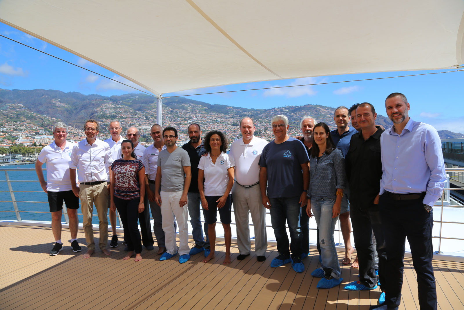
At the initiative of the Prince Albert II of Monaco Foundation, a meeting of Mediterranean monk seal experts has been held within the context of Monaco Explorations’ research on the Yersin vessel in Madeira
This meeting held today, should help create a solid, lasting dynamic between the different projects aimed at protecting Monachus monachus populations.
This momentum originated in Monaco around ten years ago. Following two workshops organised by the Prince Albert II of Monaco Foundation, which brought together Mediterranean monk seal experts, the Foundation ordered a feasibility study. The results of this study formed the basis of the Foundation’s commitment to the protection of this emblematic species. This is a commitment that has continued to develop in collaboration with the Tethys Research Institute, the Hellenic Society for the Study and Protection of the Monk Seal and WWF Greece. This collaboration, along with support from local communities, has allowed for the creation of a Marine Protected Area (MPA) around the Island of Gyaros, which is home to one of the largest Mediterranean monk seal colonies.
It is in keeping with this long-term work that the Prince Albert II of Monaco Foundation decided to bring together the leading Mediterranean monk seal experts on the Yersin research vessel when it stops over in Funchal on the Island of Madeira. The first objective is to review all the projects currently underway. The second is to prepare, with this group of experts, a major meeting as part of the Monaco Ocean Week 2018 programme, in which all the foundations from the Mediterranean and the near Atlantic concerned about this emblematic species will participate.
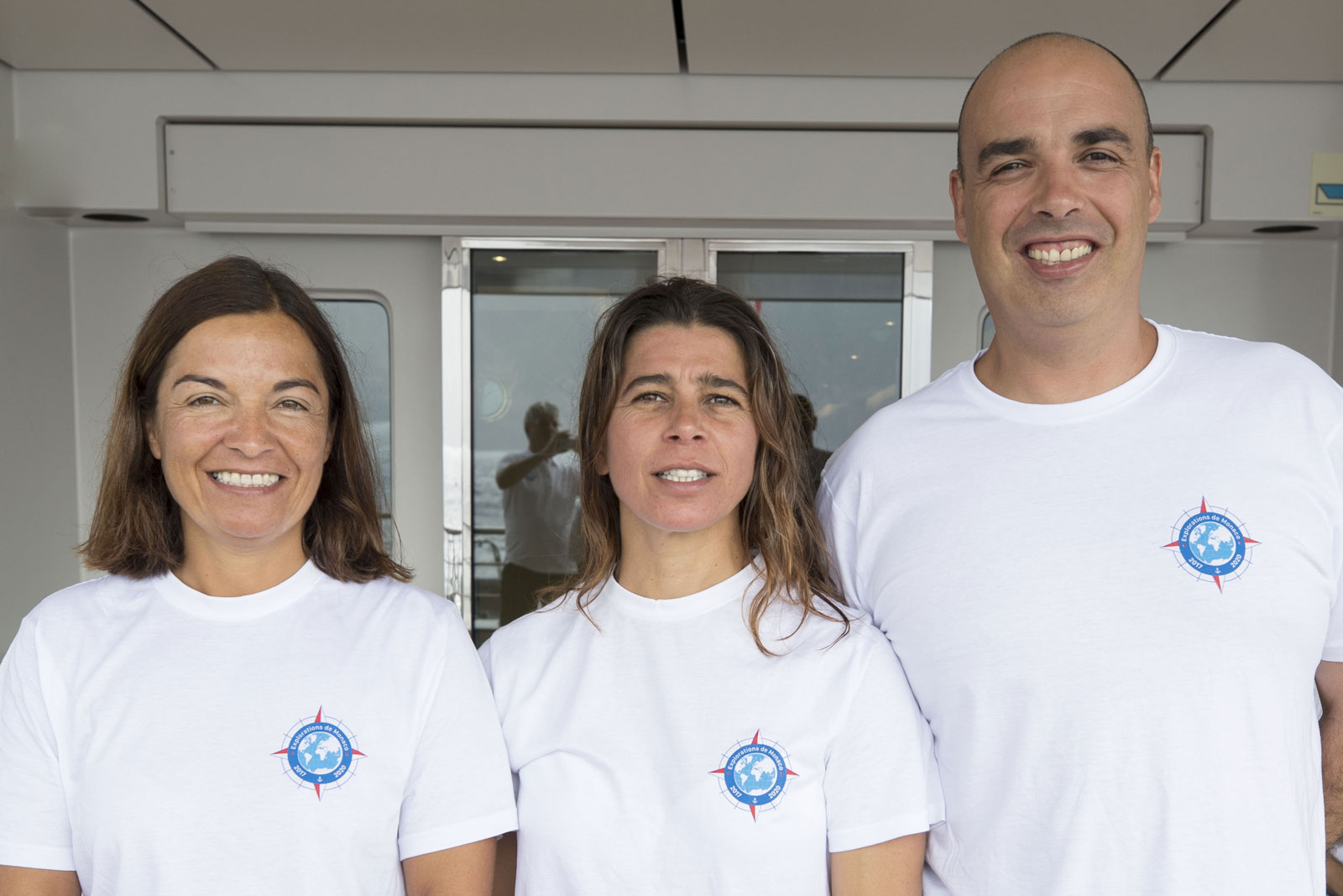
This workshop has been moderated by Paulo Oliveira, Vice-president of the Institute for Nature Conservation and Forests [Instituto das Florestas e Conservação da Natureza, IFCN]. The participants will include: Rosa Pires (Senior Technical Officer, IFCN), Luis Freitas (Head of the Science Unit at Madeira Whale Museum), Panos Dendrinos (Biologist PhD, President of the Board, MOm/Hellenic Society for the Study & Protection of the Monk Seal), Spyros Kotomatas (PhD, CYCLADES LIFE Project Leader, WWF Greece), Joan Gonzalvo (PhD, Programme Manager, Tethys Research Institute), Harun Güçlüsoy (PhD, University of Izmir, Institute of Marine Sciences and Technology), Pablo Fernández de Larrinoa (Marine Biologist, CBD-Habitat Foundation) and Philippe Gaubert (Research Fellow, Institute of Evolutionary Sciences of Montpellier).
You can follow his time here on Mission One through Monaco Explorations social networks Facebook, Instagram, and Twitter and on our blog.
The endangered monk seal population will be a focus topic during HSH Prince Albert’s time here, with a visit to Desertas Islands and a round table discussion with local conservationists aboard the Yersin.
Check out our team’s lucky encounter with one of the 44 monk seals who live here in this clip:
Saturday we said goodbye to Ana, Andreia, Inês, João, Jose, Liza, Luis, and Paulo – and after two nights in port at Funchal – we welcomed five others on board.


Our mission over the next 4 days is to travel the entire length of Madeira’s Northern coast, and with a little cooperation from the weather, we will work in two teams to map underwater sea caves and perform multiple habitat assessments.
The endangered Mediterranean monk seals population here in Madeira commonly uses sea caves for breeding and resting. By mapping that habitat it is easier to argue for the protection of those areas so that the seals are not disturbed by human activity and so that the IFCN can employ rangers to monitor the habitat areas.
Finding and mapping sea caves on land is a much easier task than finding and mapping the caves with openings that exist below the surface. Doing so requires skilled divers to search for the caves, an available vessel, and team of technical divers to record data for mapping, and above all; complete cooperation from the weather.
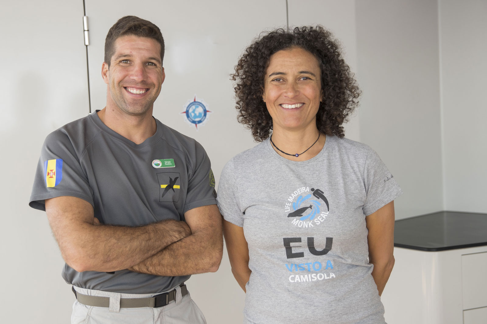
Monaco Explorations is working with Rosa Pires, Marine Biologist and Conservationist, and her colleague Sergio Pereira, Park Ranger (Vigilante da Natureza), from the Madeiran government agency IFCN (Instituto das Florestas e Conservação de Natureza IP-RAM) as well as local diving and water safety instructor, Pedro Vasconcelos.
Rosa, Sergio, and their colleagues, have mapped the sea caves that exist along the southern coast of Madeira and the caves with on-shore openings along the northern coast of the island. However, they have never had all of the right elements in place at the same time to map the caves with underwater openings along the northern coast of the island.
To find the caves with underwater openings, Rosa and Sergio first must take a tender (small boat) along the shoreline to identify areas that could have an underwater opening, which excludes any beach. Fortunately, a large section of the western part of the north coast was beach, which means we were able to cover (by elimination) a large area the first day.
At the rocky sections of shoreline, Rosa and Sergio must be able to enter the water safely and be able to visually spot a cave entrance. Because the northern coast of Madeira often has higher winds, the waters can be too rough to dive so close to the rocks and visibility can be too low to be able to see the cave entrances.
We were fortunate enough that Rosa and Sergio were able to cover the area from Ponta do Pargo to Ponta do Espigao Amarelo. From all the area surveyed, the team found one cave opening. The weather would not allow our divers to enter the cave to discover of it opens to land inside where the monk seals would go. Because the weather was better in another area in the Desertas, we traveled there so the team could map a cave that they had found the opening to previously, but had not yet had the means to enter. The team successfully entered the cave and discovered that although it opens to a breathable area, there is not space to rest. This means the cave is not a habitat area the monk seals would use.
Habitat assessments on the northern shore
We also have a team onboard from the Funchal Marine Biology Station (Estação de Biologia Marinha do Funchal). This station was developed from the Natural History Museum of Funchal, which grew large enough to dedicate an entire building to house the marine collection.
The marine station and natural history museum are a function of Camara Municipal do Funchal and are a part of the Oceanic Observatory of Madeira (Observatorio Oceanico do Funchal, OOM), which is a consortium comprised of all institutions in Madeira that work in the area of marine research.
Claudia Ribeiro, PhD in marine coastal biodiversity, Pedro Neves, scientific diver, and Mafalda Freitas, fish taxonomist and director of the station, are performing habitat assessments on the north coast as part of their work for the marine station and OOM. Because the team has historically been limited by weather, availability of a vessel and a time when the whole team could be present, this is their first opportunity to map this area.
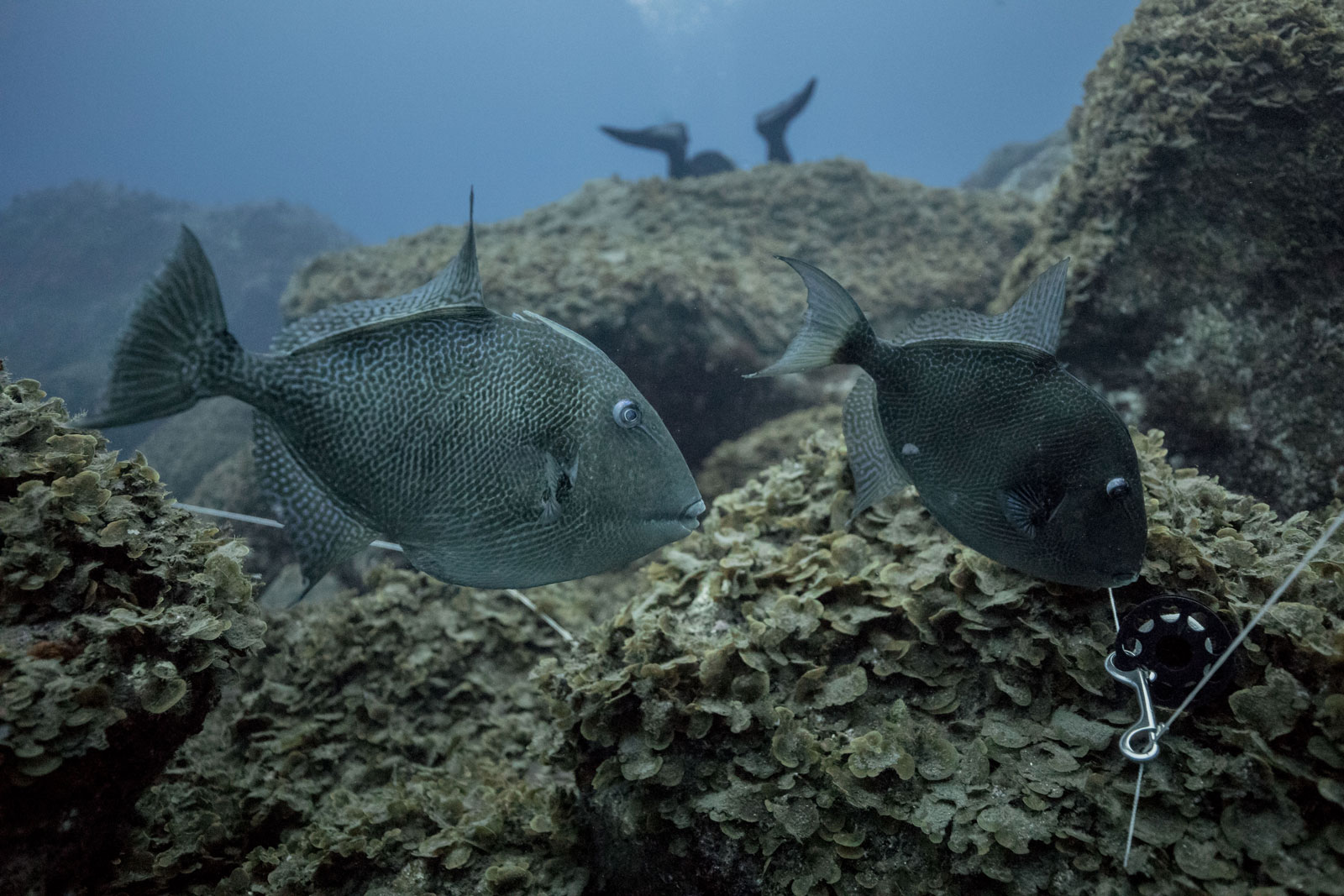
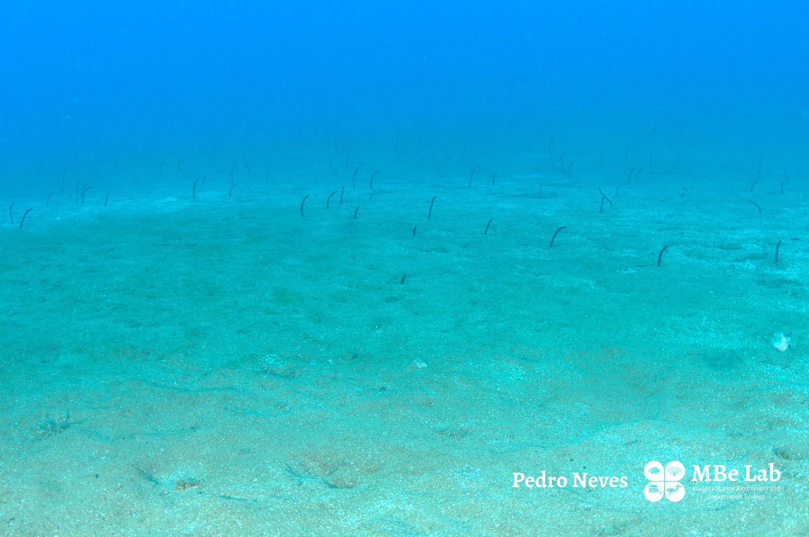
Their work on this mission includes investigating the ecosystems to find out which communities and habitats exist, and then assess their composition and diversity. This includes the study of maërl beds, garden eels, sea grass, and macro algae, to name a few examples.
The team also surveys species of tropical fish and algae, among other organisms, which have only appeared in Madeira waters in the past 20 years. While it is true that these species are here because the waters are warmer now than in the past, the team also notes that it is normal for species to migrate due to water temperature, and other factors that bring species from one part of the world to another. The importance lies in monitoring these migrations and assessing the impacts.
“Our work is to take an accurate snapshot of a particular place, on a particular date so that we can go back to the same place in future years, take a new snapshot, and make comparisons. Doing so allows us to provide scientific information to decision makers. For example, if we receive an inquiry from our government about potential development and construction in a certain area, accurate and consistent habitat assessments can assist us in answering that inquiry with scientific basis.” said Pedro Neves
Equipment and Methodology
Working in harsh environments is, of course, much more difficult than working in a laboratory. However, the methodology of the work must be applied in the field. In this case the divers must be able to manage all of their equipment, the water conditions, and the methods for doing their work all in the underwater environment. The team must be highly skilled and experienced to justify the time and expense spent to do these assessments.
[vc_row][vc_column][gem_video video_src=”https://www.monacoexplorations.org/videos/EDM_Transec.m4v” image_src=”26372″][/vc_column][/vc_row]
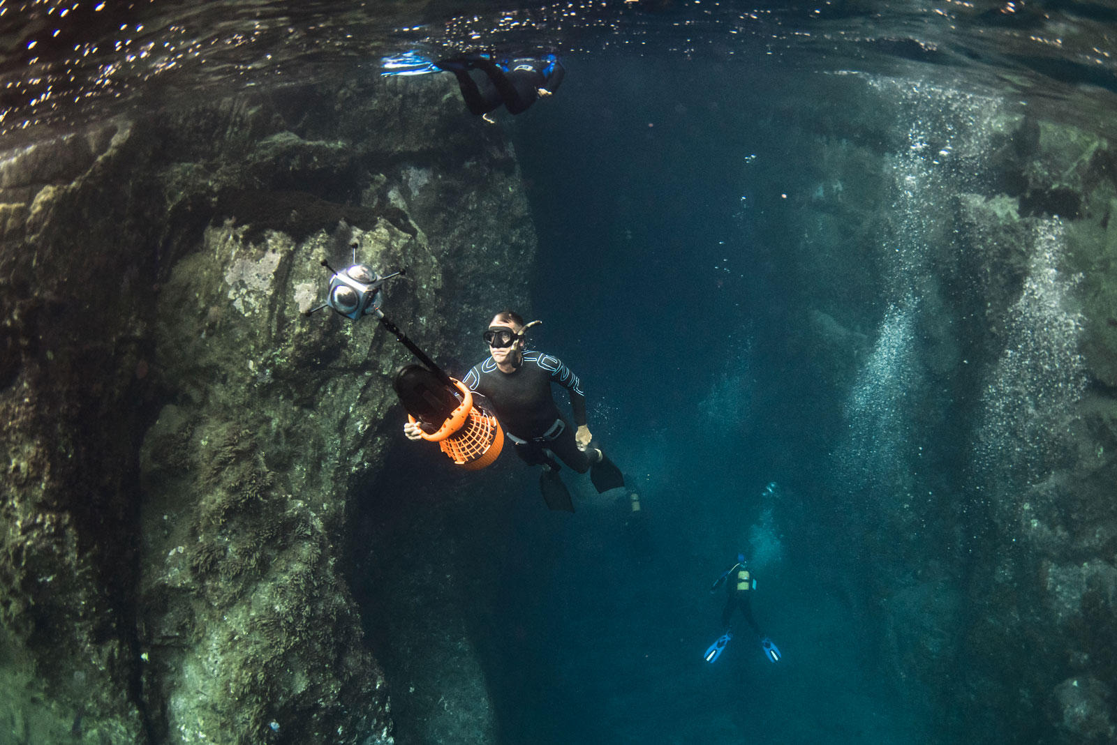
The team travels to the intended area by tender, suited to dive and with all of their gear in tow. The process of assessing and mapping the habitat includes a surface marker buoy (SMB), which carries a GPS unit recording the track covered by the divers. The SMB is connected by string to a diver propulsion vehicles (DPV), or underwater scooter, so that the buoy stays as vertical as possible with the diver. Each diver has a camera attached to them, and the GPS clock is synchronized with the clock of the cameras and the divers computer. The underwater scooters allow the divers to cover greater distances, reduce their gas consumption, and can also serve as a platform to store or attach instruments, such as cameras.
While underwater the divers use a 25 meter transect to keep their reference point while they go along the area, recording each fish and mobile invertebrate species, their sizes, the depth and time – taking a “visual census”. To do this, they use a clipboard with a list of species that are known to exist, making a checkmark and counting the specimens as they are spotted. The divers work at several depths helps to evaluate whether depth is an important factor in that particular habitat. They also make assessments at both sandy and rocky sea floors.


After returning to the surface the divers download the data which includes dive profile from the computer which tells them depth and time. The GPS tracker tells them the location and time, and finally the photos and videos are taken with time stamps. Putting all of this data together allows them to make an accurate map of the area they surveyed.
The photos and videos are also analyzed after diving to do a more detailed analysis. Often the images and videos have a more precise characterization of the bottom, and the abundance.
This team also uses the photos and video footage in their educational programming, welcoming students at the Marine Biology Station multiple times per year. If the team is able to record a fishing trap, discarded fishing gear, or trash in the sea, they can use this to educate the public about the effects of commercial and illegal fishing as well as pollution.
During our time at sea over the past days, the team was able to assess and map .4 square kilometers, or 423,000 square meters.
An overview of our first week at sea aboard the research platform Yersin in the waters of the Madeiran Islands.
https://www.youtube.com/watch?v=YE4w6Q8tu38